Types of Maps
Explore different cartographic representations used in geography and spatial analysis. From property boundaries to climatic visualizations.
10
Map Types
4
Categories
Map Names (Separate Index)
Quick Select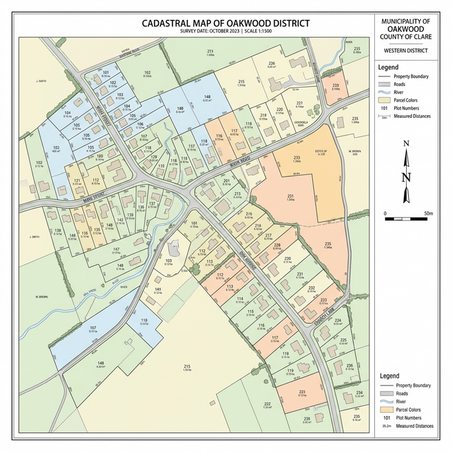
Cadastral Map
Detailed property boundaries and land ownership
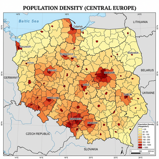
Thematic Map
Focuses on a specific theme like population density
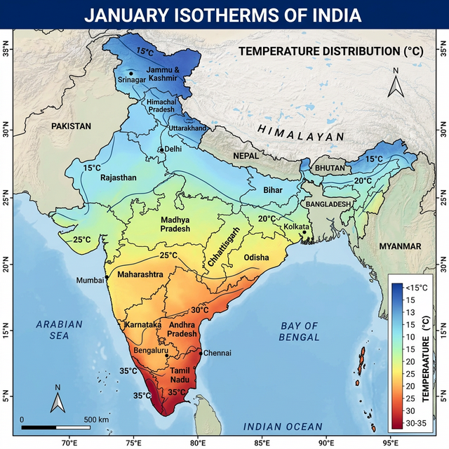
Isotherm Map
Shows areas of equal temperature
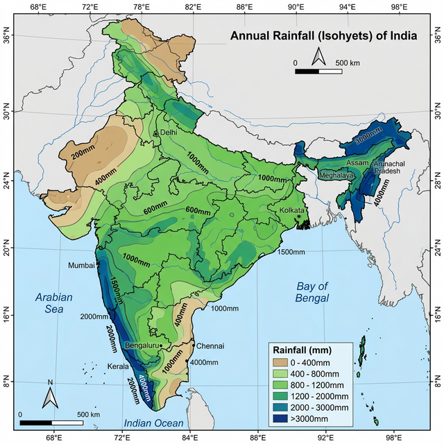
Isohyet Map
Shows areas of equal rainfall
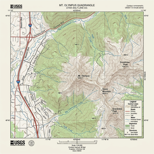
Topographic Map
Detailed terrain, elevation, and natural features
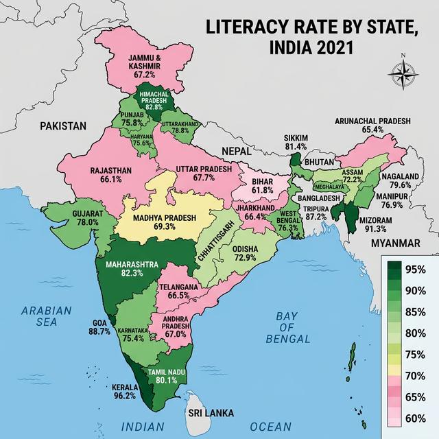
Choropleth Map
Statistical data through shaded regions
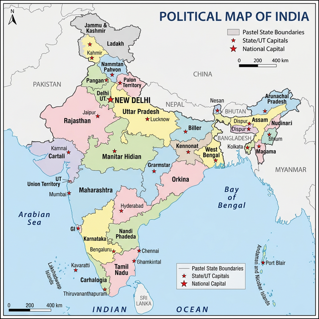
Political Map
Government boundaries of countries and states
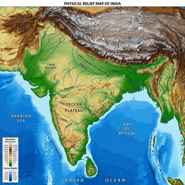
Physical Map
Focuses on geography like mountains and valleys
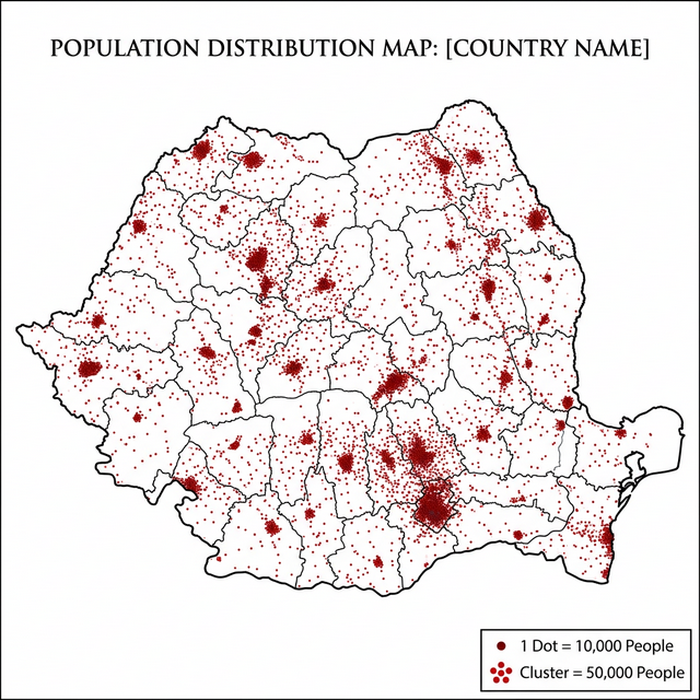
Dot Distribution Map
Uses dots to show presence of a feature
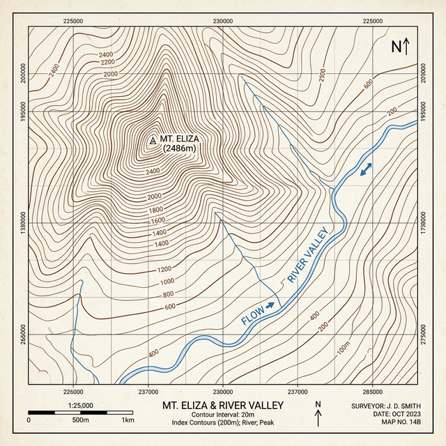
Contour Map
Shows elevation using contour lines
Live Thematic Maps
Open interactive live thematic sources for hunger, population density, sea routes, trade routes, forest fires, and hazard monitoring.
Hunger and Food Security
Live global food security and hunger indicators with country-level thematic layers.
Population Density
Interactive global population distribution and density explorer.
Sea Routes and Vessel Traffic
Near real-time vessel and maritime route activity map.
Trade and Logistics Flow
Global trade and logistics flows with country-wise thematic views.
Forest Fire Monitoring
Live active fire detections from satellite observation feeds.
Hazards and Disasters
Global disaster alerts and hazard tracking map in near real-time.